New CarryMap for Android and iOS released
We are happy to announce that the new CarryMap for Android and iOS has been released and is available for download in mobile app stores and on the website. Find out what features and improvements have been implemented!
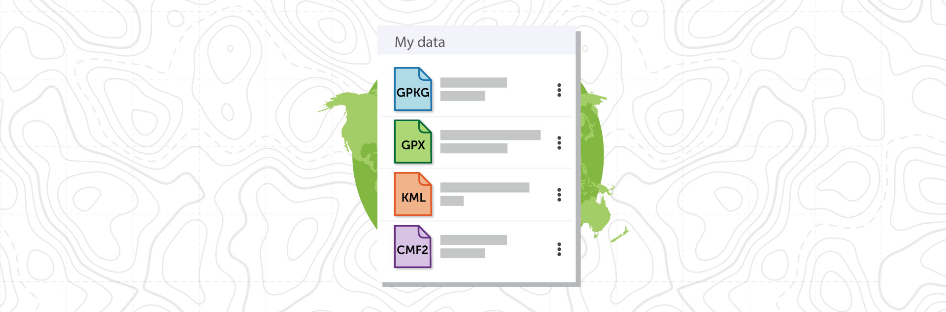
Fast access to the data catalog
The ’My Data‘ tab has been added to the app start page, which provides access to data in GeoPackage, KML/KMZ, GPX, SHP formats stored in the app folder of the device. The tab allows you to share and delete files.
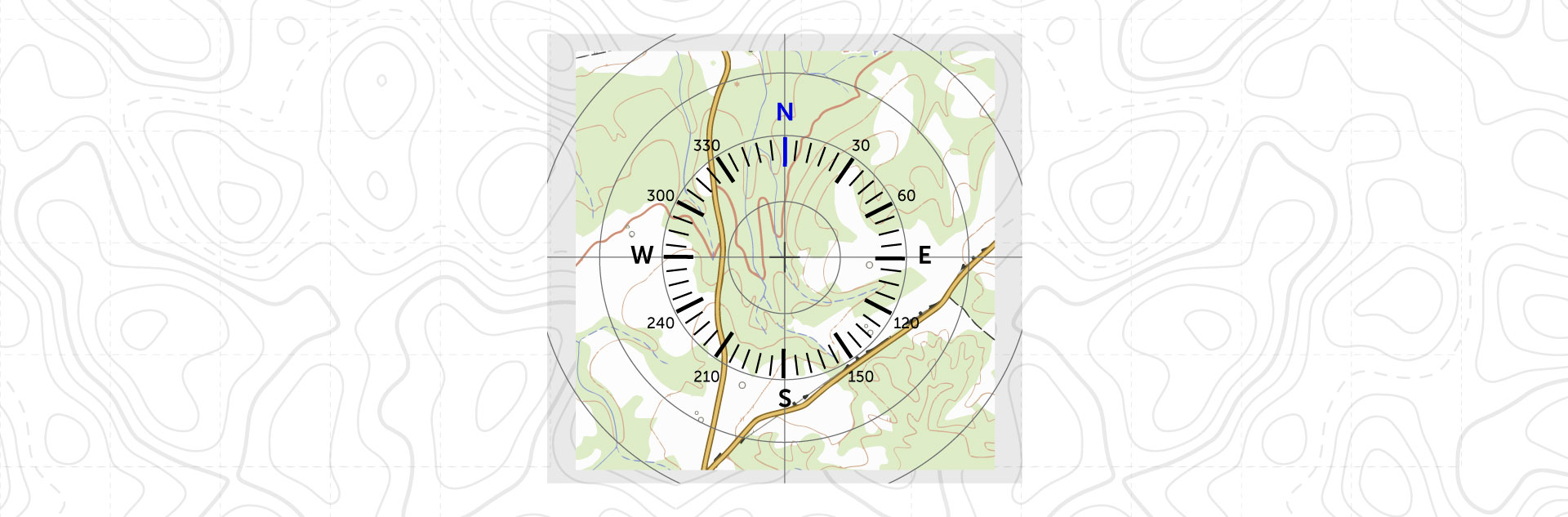
Circular ruler
The circular ruler is designed to measure distances and determine directions on the map in real time. This tool allows you to quickly determine location of objects equidistant from the selected point; it is enabled and disabled in the app settings and changes appropriately when zooming the map.
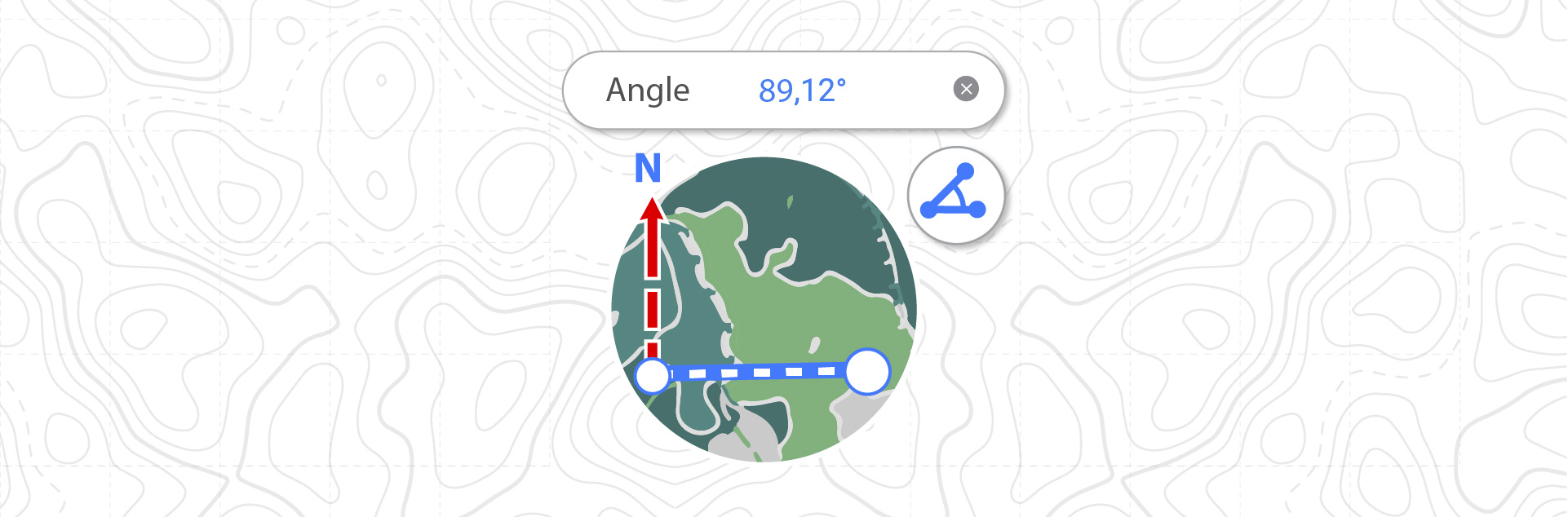
Geographical azimuth
In the new app version a tool for measuring azimuth has been added. Now it is possible to navigate the territory using azimuth.
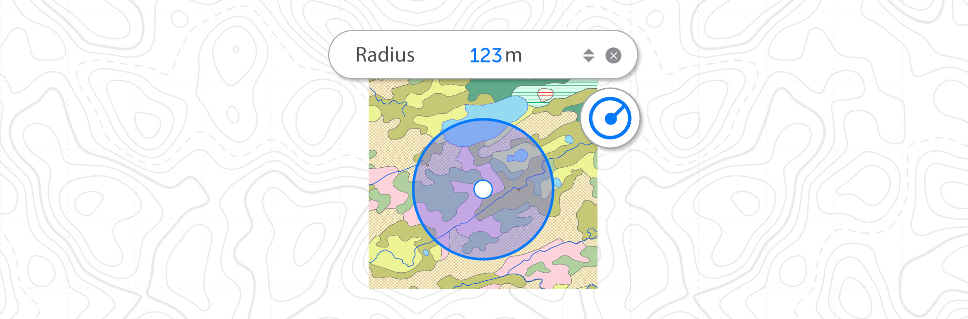
Measuring the circle radius
The tool for measuring the radius of a circle with the center at the selected point by a given value is added. This tool allows you to display a circle of a given radius on the map and determine which objects fall into it.
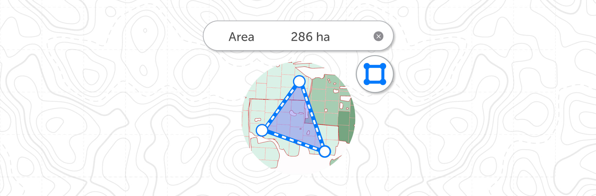
Measuring the area in hectares
The possibilities of calculating the area on the map are extended in the new app version. Besides square meters or kilometers you can now also choose hectares as the area measurement units. Calculations are made in selected units.
Saving the project
A project is a set of maps and data layers with specified parameters. Now projects in the app are automatically saved when a layer of any type is added to the map. For example, projects can consist of an unlimited number of maps or data.
Other
Fixes related to stability and performance improvements.
Download the CarryMap app for mobile devices
CarryMap Team


