The basic terms of the CarryMap application

We are happy to present you the basic terms of the CarryMap application to make it even easier and more efficient to use it when collecting field geospatial data.
Mobile interactive map is a digital map of the area provided to view and work with it on mobile devices. The data transfer in mobile map is carried out in a two-way mode for the user. Such maps contain open information visible right after the map is open, and closed information which appears upon the user’s actions only. The mobile application CarryMap is provided for work with mobile interactive maps in .CMF2 format. This format allows you to quickly draw a map on a mobile device, provides effective data compression (created maps are more compact) and has some other advantages.

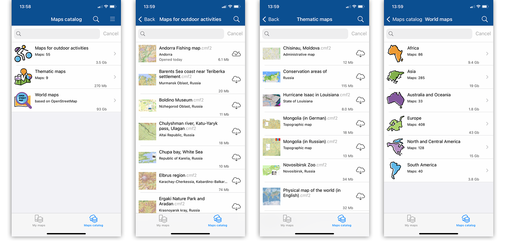
Maps catalog is a storage of mobile interactive maps in CMF2 format available for download with Internet connection. It stores different thematic maps as well as maps of world regions based on OpenStreetMap data.
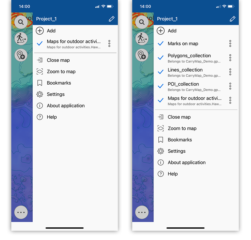
Project is a set of maps and data layers with specified parameters. A project can consist of an unlimited number of maps or data layers.
Coordinate system of the map and project is a set of definitions that implements the coordinate method, that is, a way to determine position and movement of a point or a body using numbers or other symbols. Coordinate systems also known as cartographic projections are random designations of spatial features. There are two types of coordinate systems, the geographic and projected coordinate system. The coordinate system of the mobile map in .CMF2 format is set during the map’s creation, while the coordinate system of the project is determined based on the coordinate system of the project’s lower layer.
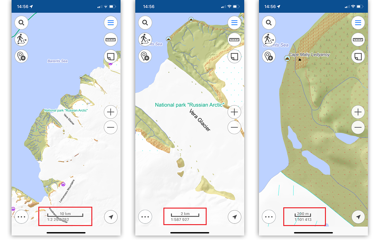
Map scale is the proportion of the segment length on the map to its actual length on the area. Map scale at each point has its own particular value depending on the latitude and longitude of this point.
Map extent is a selected area on the map. Map extent captures spatial data at a particular scale.
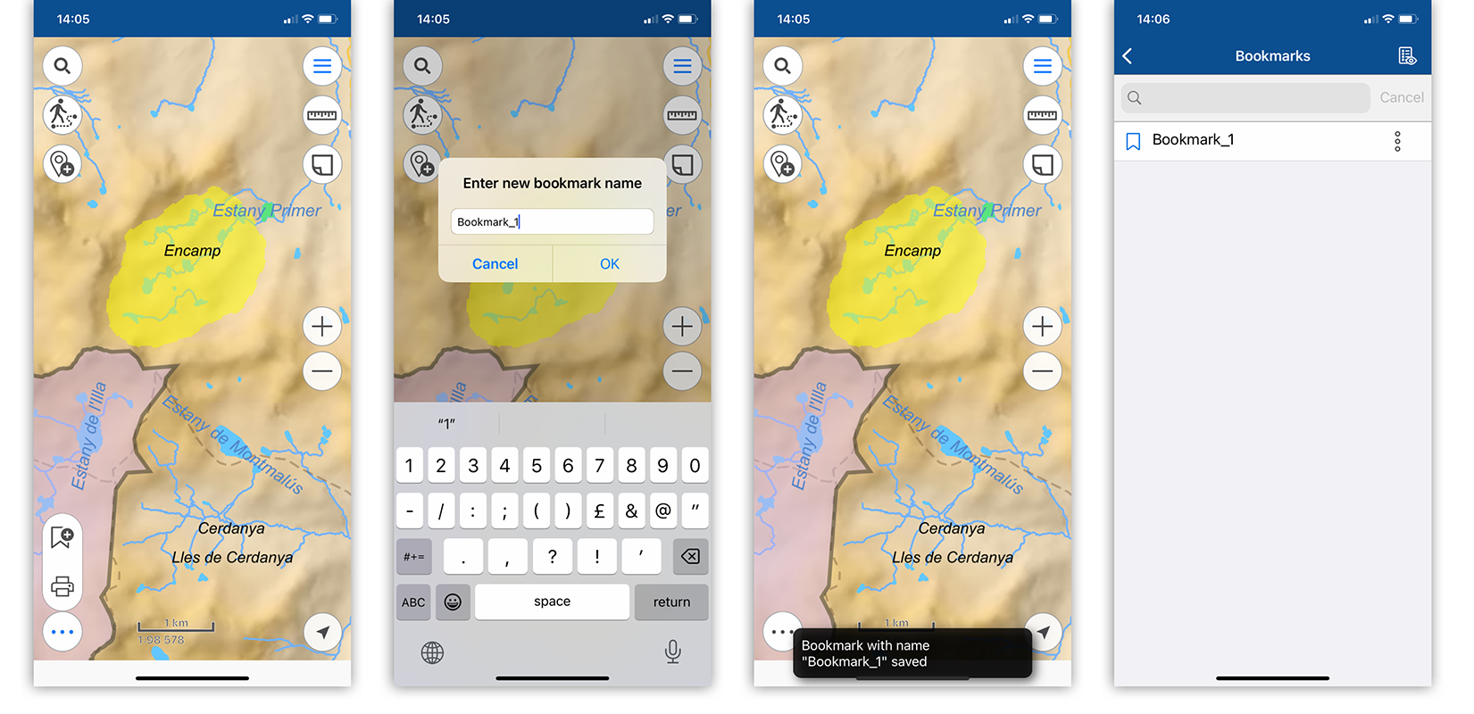
Bookmark is a saved extent of the map. Bookmarks are useful while working with big spatial data, as you can quickly refer to the needed extent.
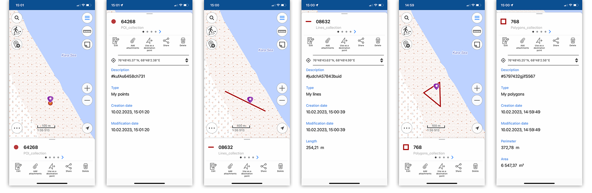
Spatial feature is a feature that stores its geographic representation as point, line or polygon as one of its properties (fields) in a line. A feature as an entity has coordinates, name, belonging to a data layer and can have description, media attachment.
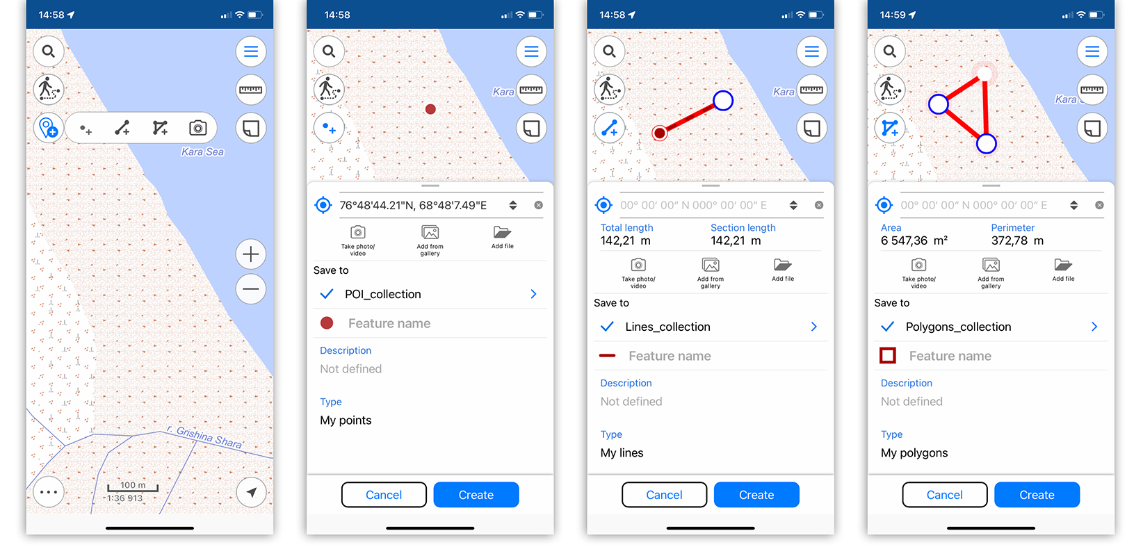
Feature coordinates are a set of numbers that determine position of feature on a line, plane, surface or in space. The mobile app CarryMap allows you to work with the following coordinates representation formats:
- Degrees-minutes-seconds (DMS). Coordinates are displayed and set when searching and creating a feature in the form 00°00'00" N/S 00°00'00" E/W (latitude and longitude);
- Decimal degrees (DD). Coordinates are displayed and set when searching and creating a feature in the form X 00,00000 Y 00,00000 (latitude and longitude);
- UTM-meters. Coordinates are displayed and set when searching and creating a feature in the form X 000000,00 Y 000000,00 (latitude and longitude).
Attachment is a multimedia file (photo, video, audio, document) added to any type of feature (point, line, polygon). Types of media attachment supported in the mobile app CarryMap are jpeg, png, doc, pdf, txt, mp3, avi and etc.
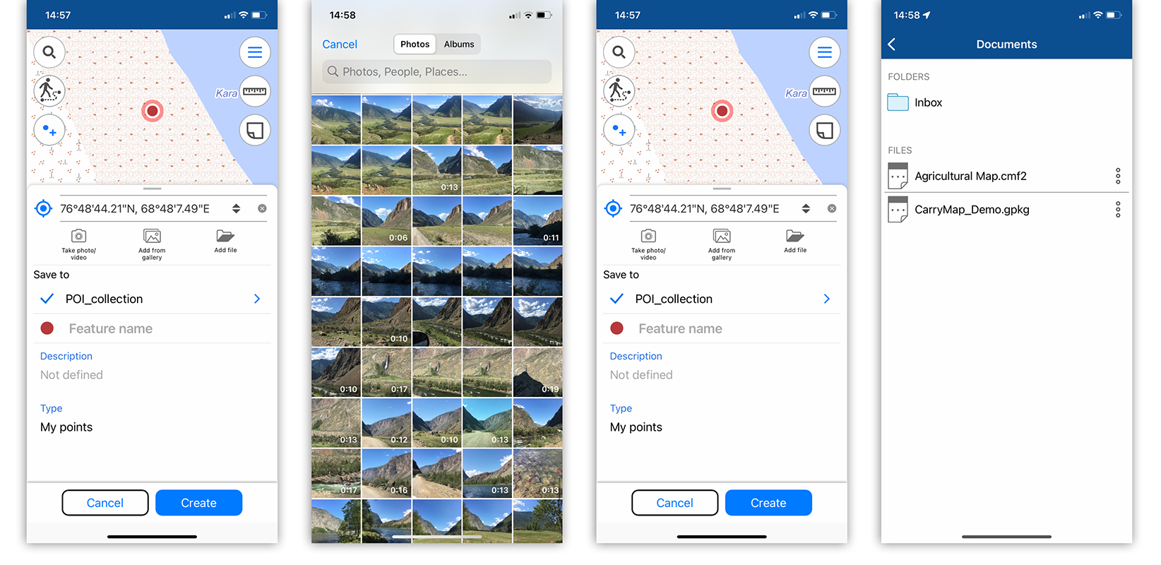
Identification card is information about a feature that appears while selecting a feature on the map. An identification card contains attribute information about a feature and attachments as photo or media files, if any.
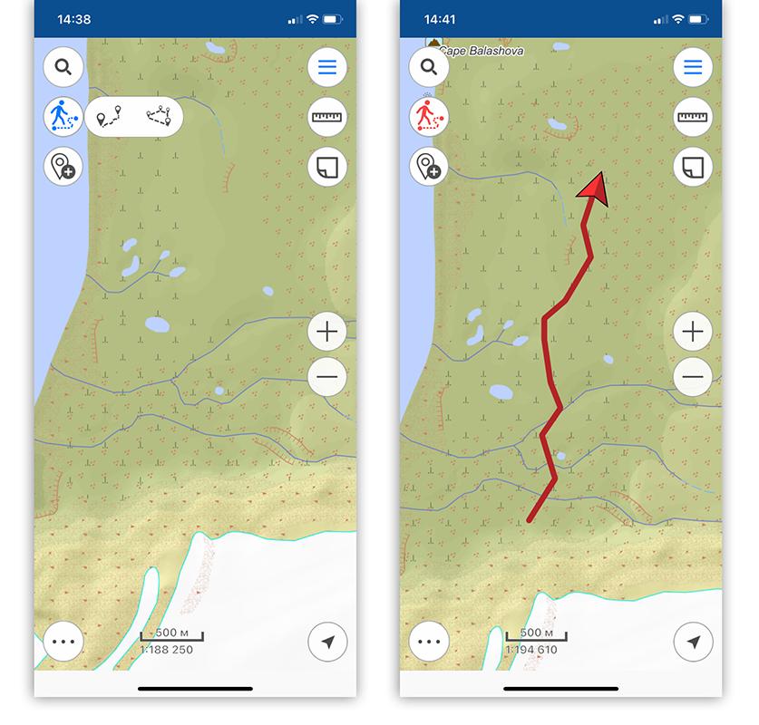
Track is a sequence of GPS coordinate points with timestamps. In the mobile app CarryMap you can record GPS-tracks and show the current route on the mobile map.
Learn more about the CarryMap app in the Help.
CarryMap Team


