New CarryMap for Android and iOS

We are happy to announce that the new CarryMap version has been released and is available for download at Google Play and App Store. Find out what is new in CarryMap.
What’s new in CarryMap
We have significantly reworked the user interface of the app. Moreover, we have improved the feature creation and editing processes by adding new optional features, and updated the identification cards when identifying, creating, and editing features.
Updated identification cards of feature creation and editing
Now it is possible to remember the last selected symbol while creating the new feature in one layer, that has significantly optimized the process of creating multiple features of the same type.
When creating and editing polyline and polygon features now there is the additional information about the created feature in the field under the coordinates window. ‘Total length’ and ‘Section length’ are the parameters for polyline features, ‘Area’ and ‘Perimeter’ are the parameters for polygon features.

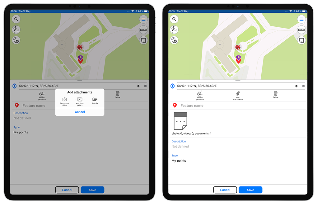
Now there are more options available by adding attachments to features. When you tap the ‘Add attachments’ button, the dialog window appears, where you can select the needed option from the list: ‘Take photo/video’, ‘Add from gallery’, ‘Add file’. When you tap the ‘Take photo/video’ button you are prompted to take the photo or video of the site and add it as the attachment to the created feature.
Unique symbology of GeoPackage layer
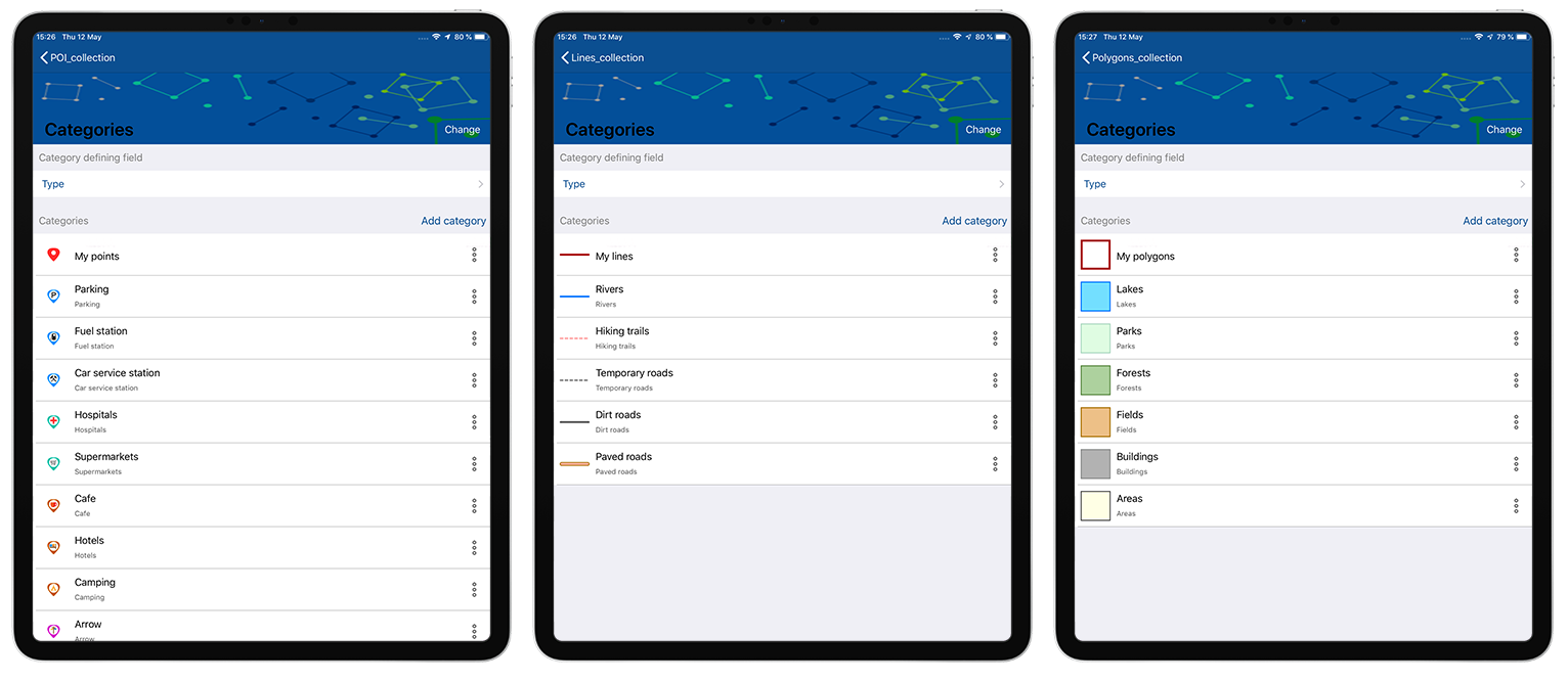
Now it is possible to download the GeoPackage layer symbology categories based on the unique feature values of the ‘Text’ and ‘Integer number’ fields. This feature has significantly improved and optimized the categories creation process.
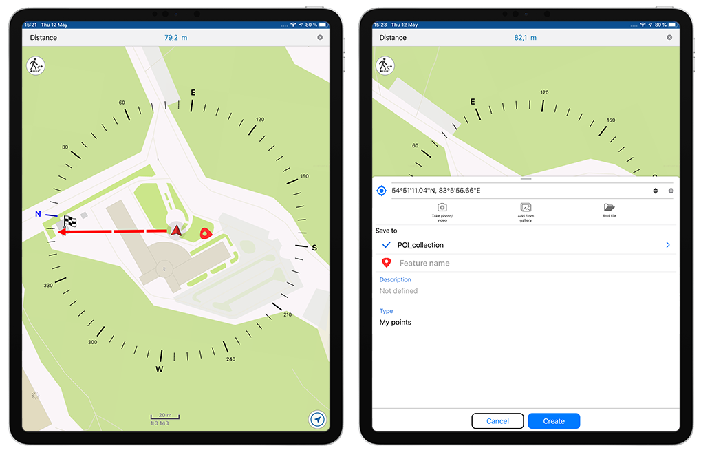
Updated ‘Use as a destination point’ tool
Try the updated tool as you move towards the selected place on the map. The compass appearance has been changed: a red arrow of the current location has been added and now the direction to specified target is marked by the red line within the limb. The ability to create the feature in your current location has been preserved, to do so, you need to tap the location mark icon in the center of the limb.
Return to the full map extent
Try the option of returning to the full map extent for more convenient map navigation.
Support for Z coordinates
CarryMap provides the ability to export/import data with support for Z coordinates in all available formats, to record and store the information about the height in the vertices of polyline and polygon features and points features when creating the point in the current location and recording the track (creating the polygon based on the track).
Maps in the old CMF format
With the new CarryMap release the old CMF format is not more supported, which means the old maps in CMF format are not automatically converted to the new CMF2 format when opening files. Now you will need to convert your CMF maps to the new CMF2 format using CarryMap Builder, the Desktop extension to ArcGIS. To do so, launch (install) the extension and run the ‘Convert CMF to CMF2 files’ tool. To learn more about the tool work, watch the video tutorial ‘How to convert CMF file to CMF2’.
Minor bug fixes and enhancements
Download the CarryMap app for iOS devices
Download the CarryMap app for Android devices
CarryMap Team


