New CarryMap for Android and iOS are released
Learn what’s new in the most recent version.
We are happy to announce that the new CarryMap version has been released and is available for download at Google Play and AppStore. Find out what is new in CarryMap.
What’s new in CarryMap:
We have significantly renewed the user interface of the app, as well as improved and optimized the logic of feature creation process. For users’ convenience, all the tools used to create and edit features have been moved to identification card.
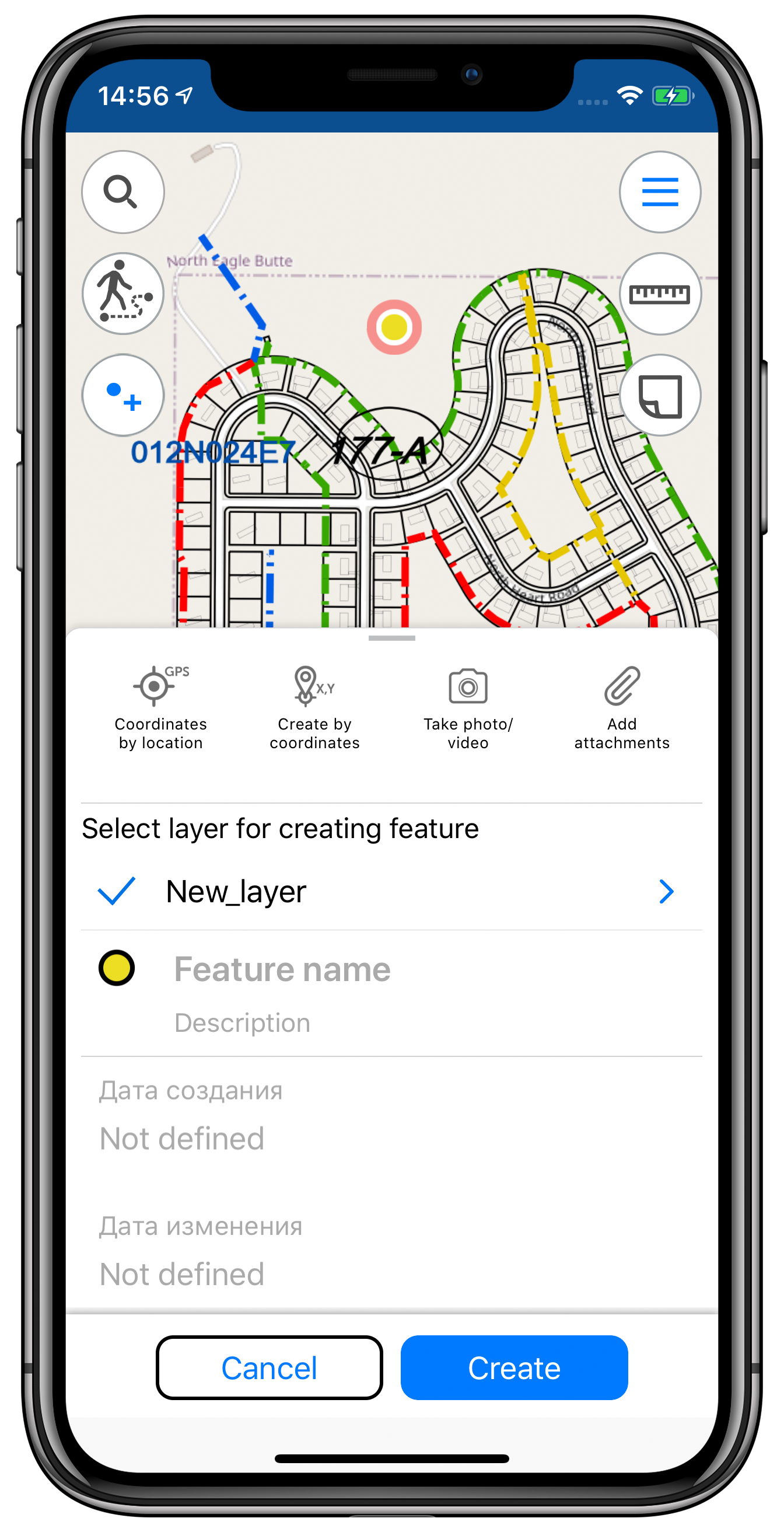
Feature creation
- Now the process of creating feature starts with selection of its type: point, line, polygon.
- In the identification card you can now make all operations available during the feature creation process:
- enter feature name and description,
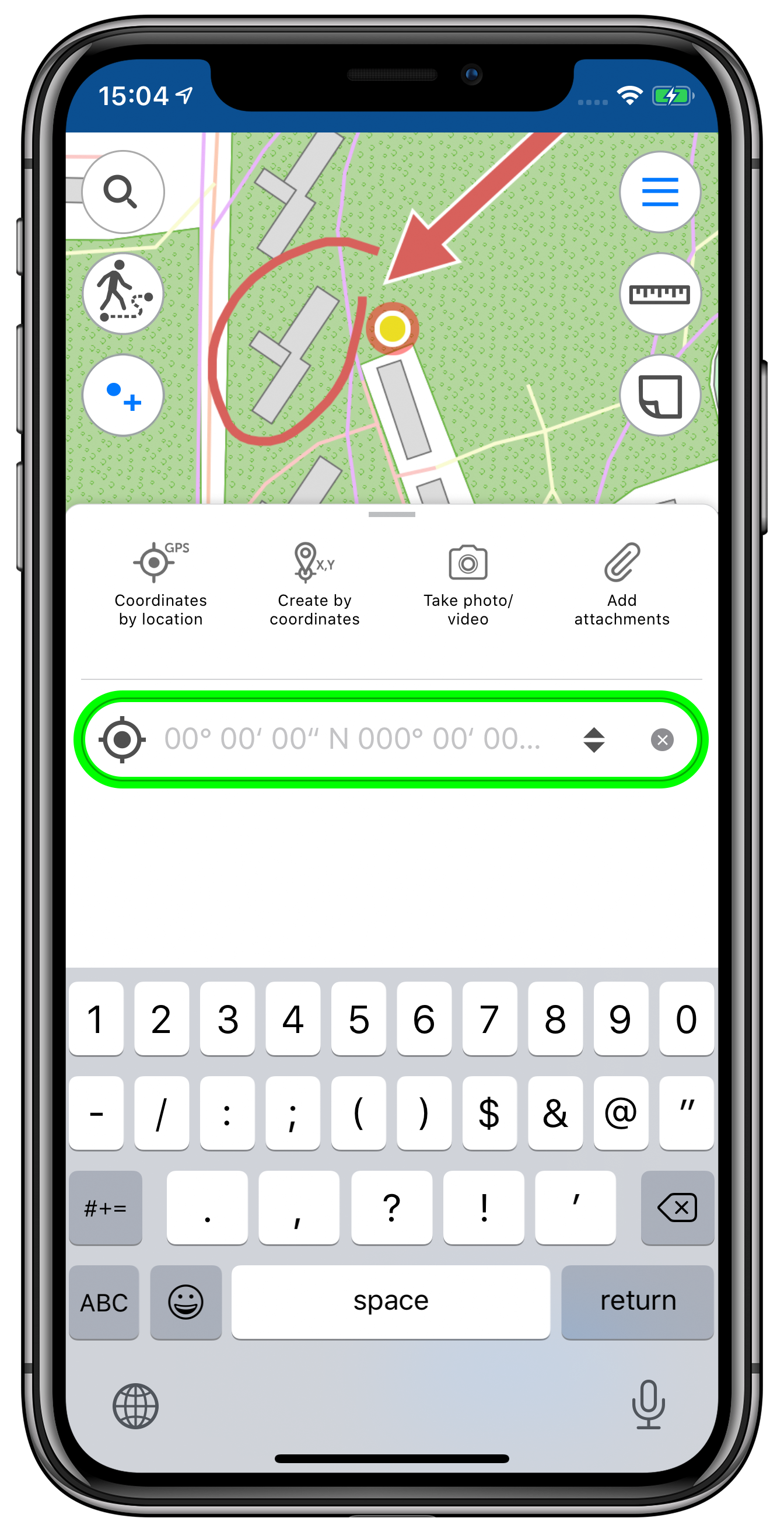
- create points by coordinates in DD or DMS formats,
- create points by current location.
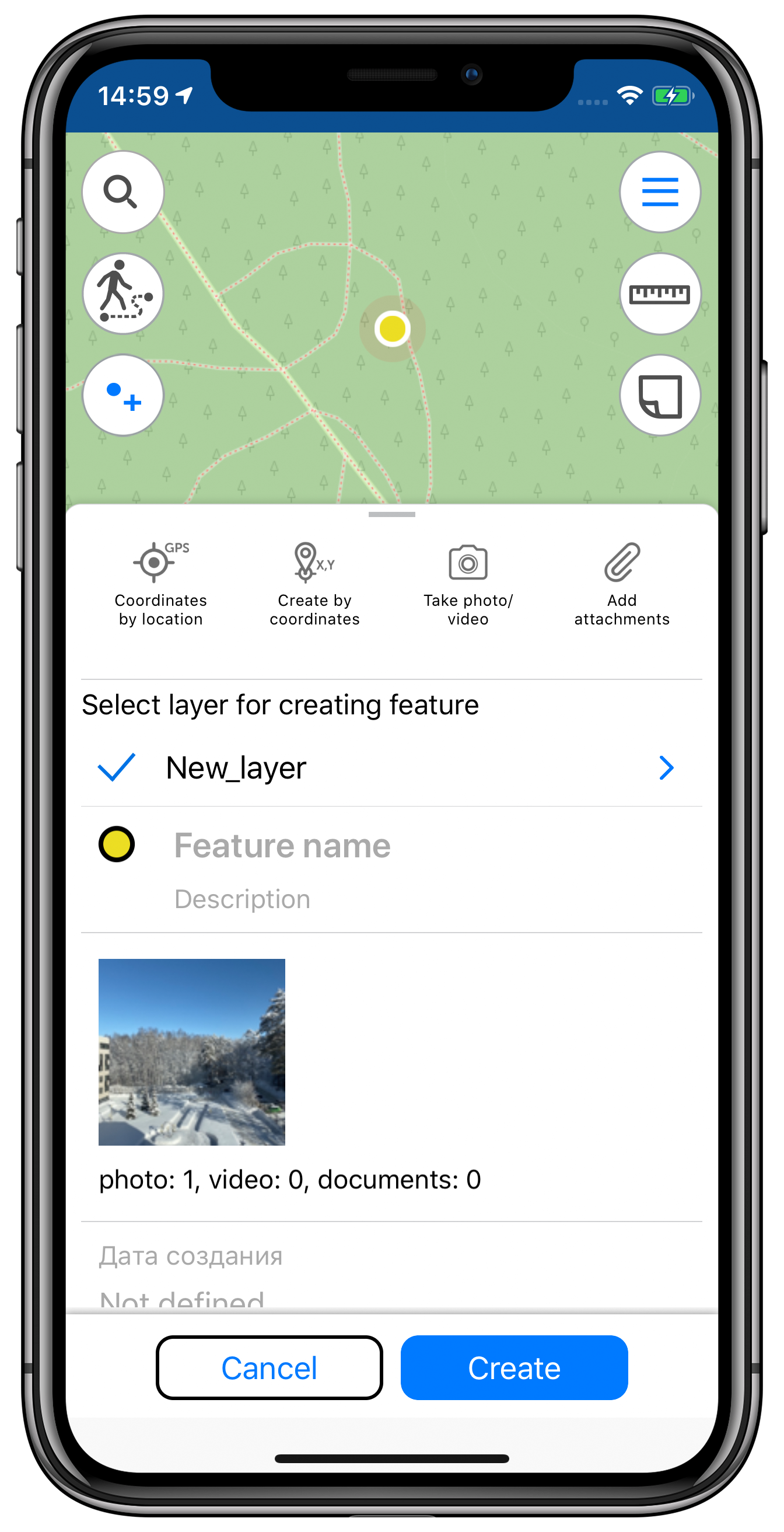
- Now it is possible to add attachments of any formats on-the-fly using your device camera or selecting from the
- The layer symbology settings have been moved to the identification card. In the previous versions these settings were in the main application menu.
- When creating feature of any type (point, line or polygon), the layer where this feature is created is now remembered in the current project. By default this particular layer is displayed in the identification card when saving all the new features afterwards.
- When creating point features, the point is now automatically placed at the center of the current map extent. To change its location, just drag the point to the required place on the map during the feature creation process.
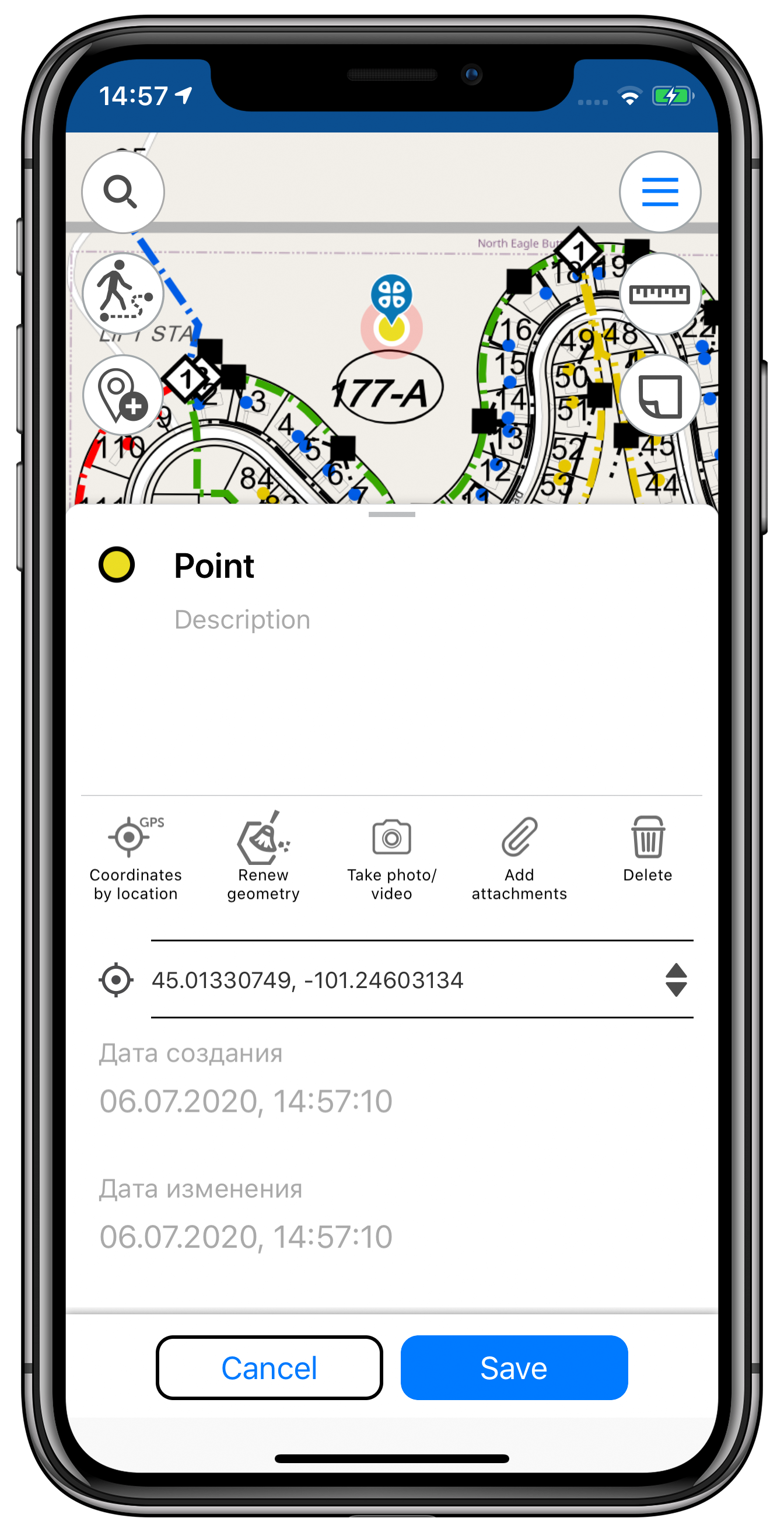
Feature editing
- In the identification card you can now make all operations available during the feature editing process:
- edit feature name and geometry,
- add attachments of any formats on-the-fly using your device camera or selecting from the gallery,
- delete feature,
- change feature coordinates to coordinates of the current location.
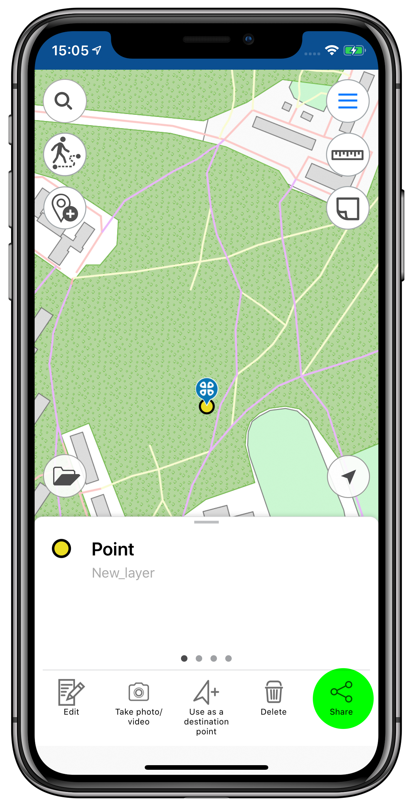
- The option to share selected feature in all available formats (SHP, GPX, GeoPackage, KMZ) has been added to the identification card.
- In the upper part of the identification card there is now a preview window for the added photo attachments and the total amount of feature attachments is displayed.
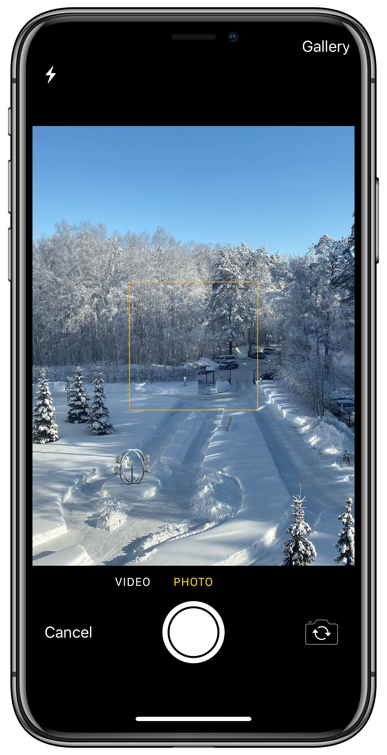
Creating points by photos
The process of creating point features on-the-fly using the device camera has been simplified. Now you just need to take a photo of the site or download the existing photo from your gallery and the feature location will be defined based on the photo coordinates.
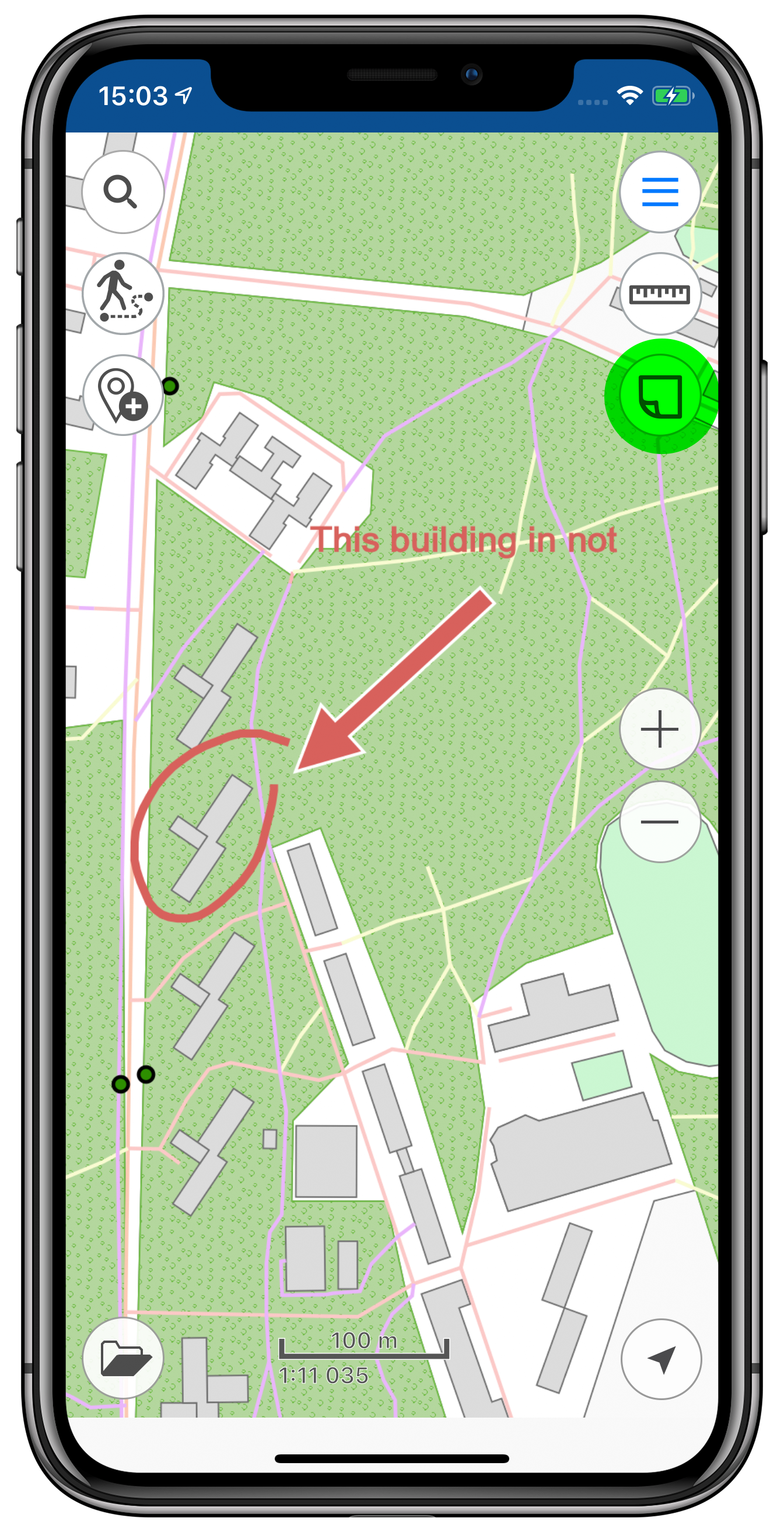
Graphic marks
With this new option of adding graphic and text marks, your map will be even more descriptive and demonstrative. Thus, adding arrows or drawing free hand graphic on the map, you can mark the places you need to remember or which you want to show your colleges upon returning to the office, or mark the features that need to be defined more accurately and complemented later.
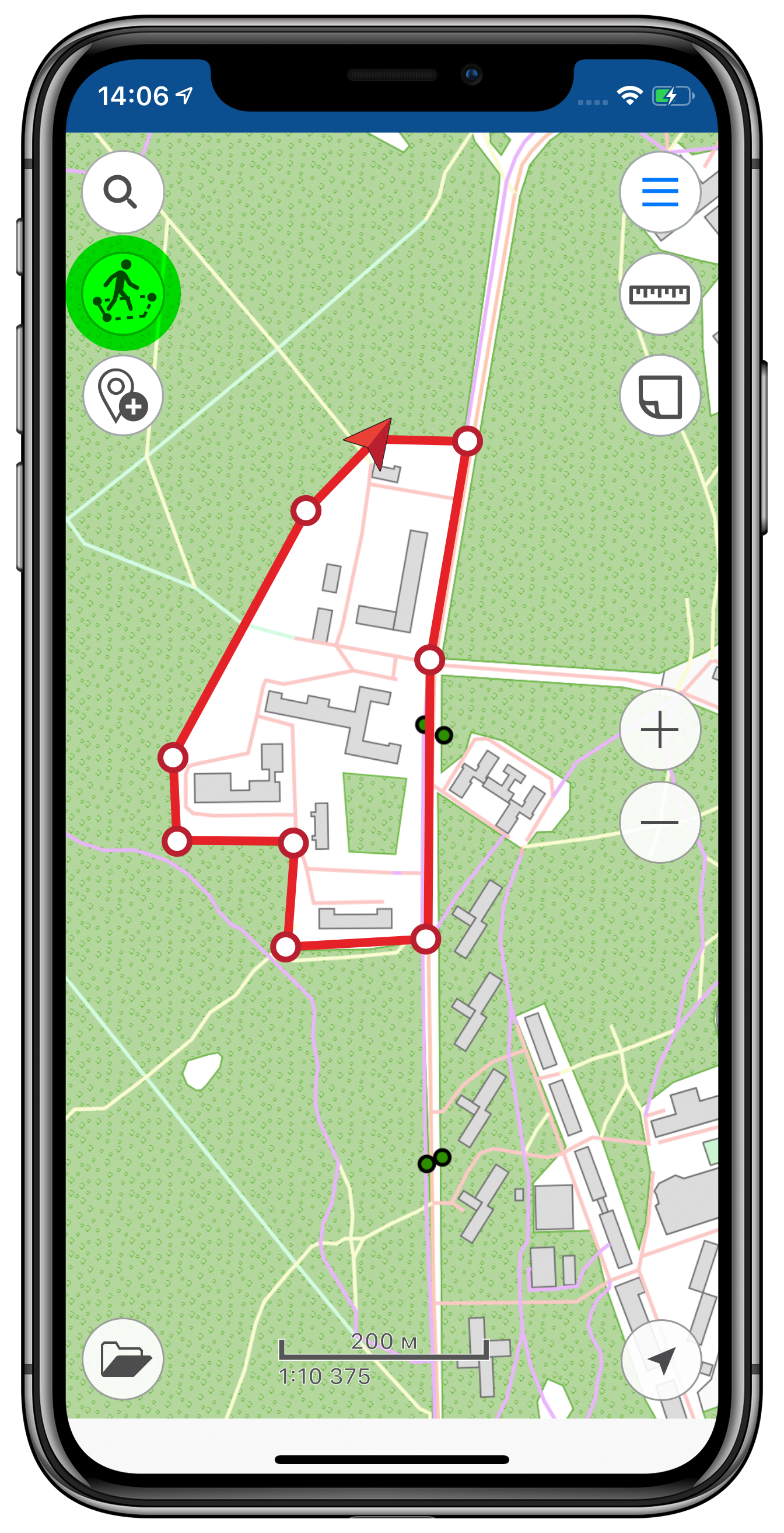
Creating polygons by GPS tracks
To contour complex polygon features that cannot be seen due to large area or specific location, the new tool provided to create polygons by recorded tracks would be very handy. Using this new option you can walk/drive/fly around the needed territory defining its boundary and area. Note that creating polygons by tracks can be done even in the background mode, so you will be able to use any other app options during the track recording.

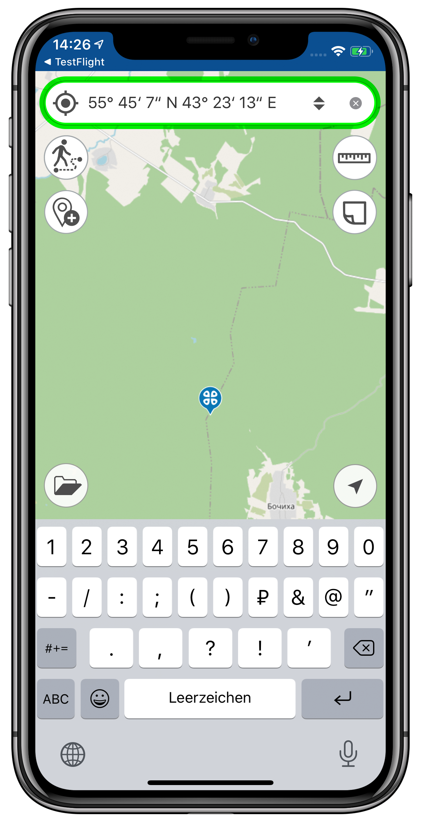
Going to coordinates
The search functionality of the app has been also improved and optimized. The search bar with the magnifier icon provided for text and numerical search by attribute fields of GeoPackage features or CMF2 maps has been added. You can switch between coordinates display formats, selecting DD or DMS. For each format, the sample/prompting message showing the correct coordinates entry will appear.
Creating features by coordinates
The option of creating features by coordinates has been improved and moved from the ‘Create features’ menu to the identification card of the created feature. Now it is available for point, line, and polygon features in DD and DMS formats. To use the tool, tap ‘Coordinates by GPS’ and the point with coordinates of your current location will be added to the geometry of the created feature.

Coordinate system of maps and layers
Now when you change coordinate system of layers or maps, the correspondent message is shown.
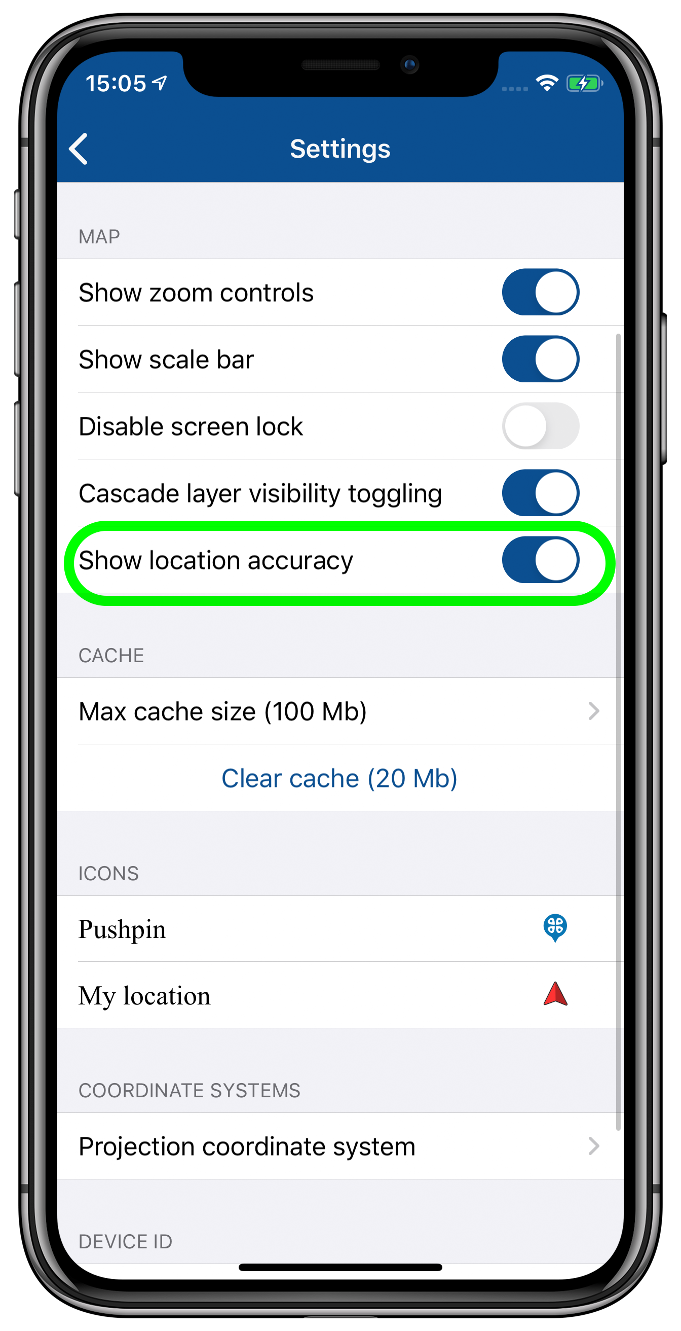
Location accuracy buffer
The new option allowing to show/hide the location accuracy buffer on the map has been added to the app settings.
Exchanging features
The new button used to share either complete layer or selected features of the layer in any formats supported in the app has been added to the feature identification card.
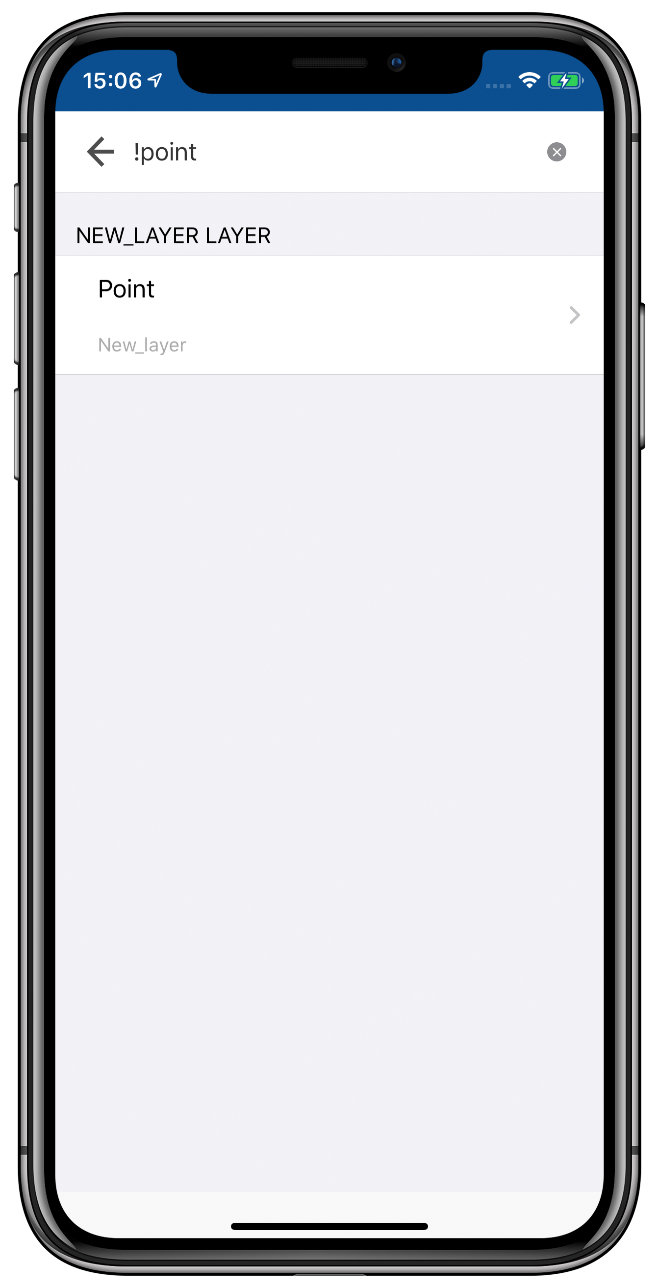
Accurate map search
The search functionality of the app has been extended with the new accurate search option. Now you can search not only for the separate word, but also for the whole phrase. To do so, enter the ‘!’ sign in the beginning of your search query, and the search result will show only the requested number, word or phrase. This new option will simplify searching through big arrays of numerical and text data.
Specifying destination point
The device battery consumption during use of the ‘Use as a destination point’ option’ has been optimized.
Minor bug fixes and enhancements
CarryMap Team


