Using CarryMap technology in the forestry management
Applying CarryMap technology to support forestry management activities in Germany
European forestry originated in Germany in the mid-19th century, when forest management was intended to protect forests from massive devastation. The fundamentals of the Russian forest management system and forest inventory were adopted from the German forestry. Russian foresters of the last and before last century undergone trainings in Germany, translated works of German experts, and applied principles of the German forestry management in management of Russian forests.
Today, each central forest management body in Germany has its own division providing complex services on forest inventory and planning for each forestry. At that, such works can be maintained both by government facilities and private companies.
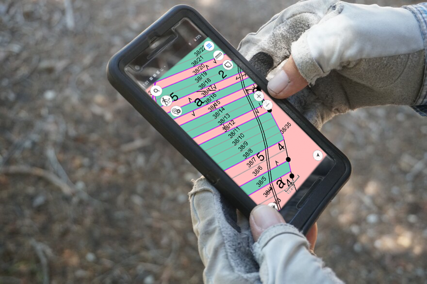
One of such private German companies, Ingenieurbüro Fischer, prepares digital maps of forest lands based on the ArcGIS platform and using high resolution air photos. The company’s owner, Uwe Fischer, shared his experience on applying CarryMap technology to support state and private forest owners, for example commercial farmers. He uses CarryMap Builder, an extension to ArcGIS Desktop, to create interactive mobile forest land maps and for onsite work with these maps he uses CarryMap, a free application for iOS and Android devices.
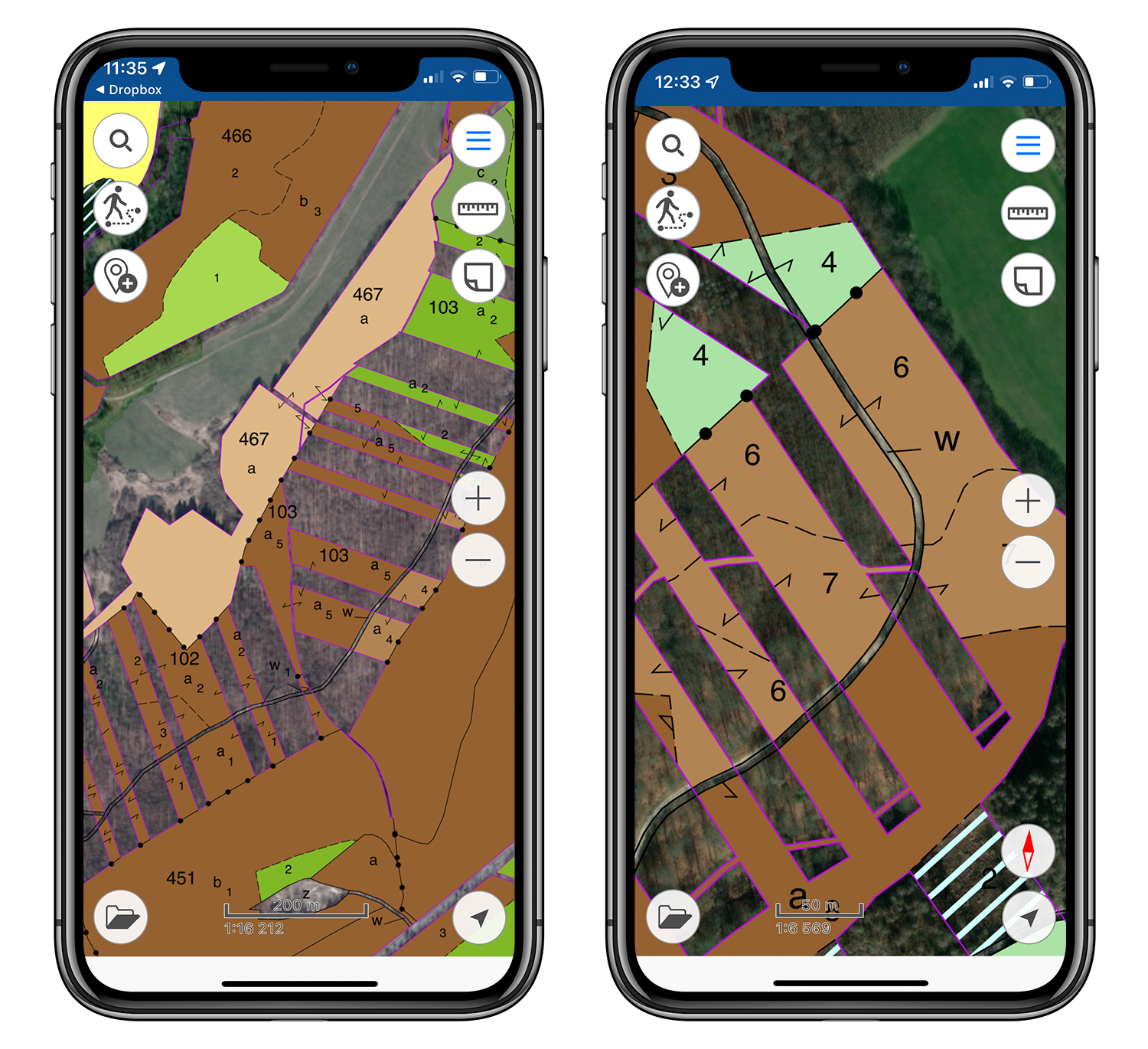
Map of forest resources
German forest economy is not only about the cost-benefit analysis of forestry, but also about consideration of various non-economic factors such as soil conditions, climate and rainfall, suitability of target tree species to sites, and, of course, inventory and forest management. The forest economy cannot exist without planning, all forest management projects in Germany are drawn up for a period of 10 years. The planned parameters of forest management are considered in the annual business plans of forestry facilities, and the results of forestry management are monitored by authorized forestry centers.
German forest management includes multiple activities, to name a few:
- Forest taxation (determination of quantitative and qualitative indicators) of forests considering their specific functions related to forest management (species composition, structure, reserves, etc.).
- Analysis of the industry impact on the forest resources development.
- Ten-year forest management planning based on interests of forest users and goals of forest land owners.
All these activities are maintained using GIS technologies allowing the experts to keep the forest land maps updated by adding the current forest data to the maps and to analyze the forest health over time.
For some years, Ingenieurbüro Fischer has been providing a wide range of forest owners with the forest lands mapping services using CarryMap Builder extension. Uwe Fischer also creates provisionally maps for his colleagues from other companies who perform the forest management works onsite. Ingenieurbüro Fischer also prepares maps following the results of the forest management projects which are very important for analysis of works made during the past decade, for evaluation of the latest completed operations, for consideration of the pros and cons of the latest plan, and for correction of plans for the next ten-year period. Upon completion of such inventory, the updated forest land maps are created and distributed among the field staff for using onsite.
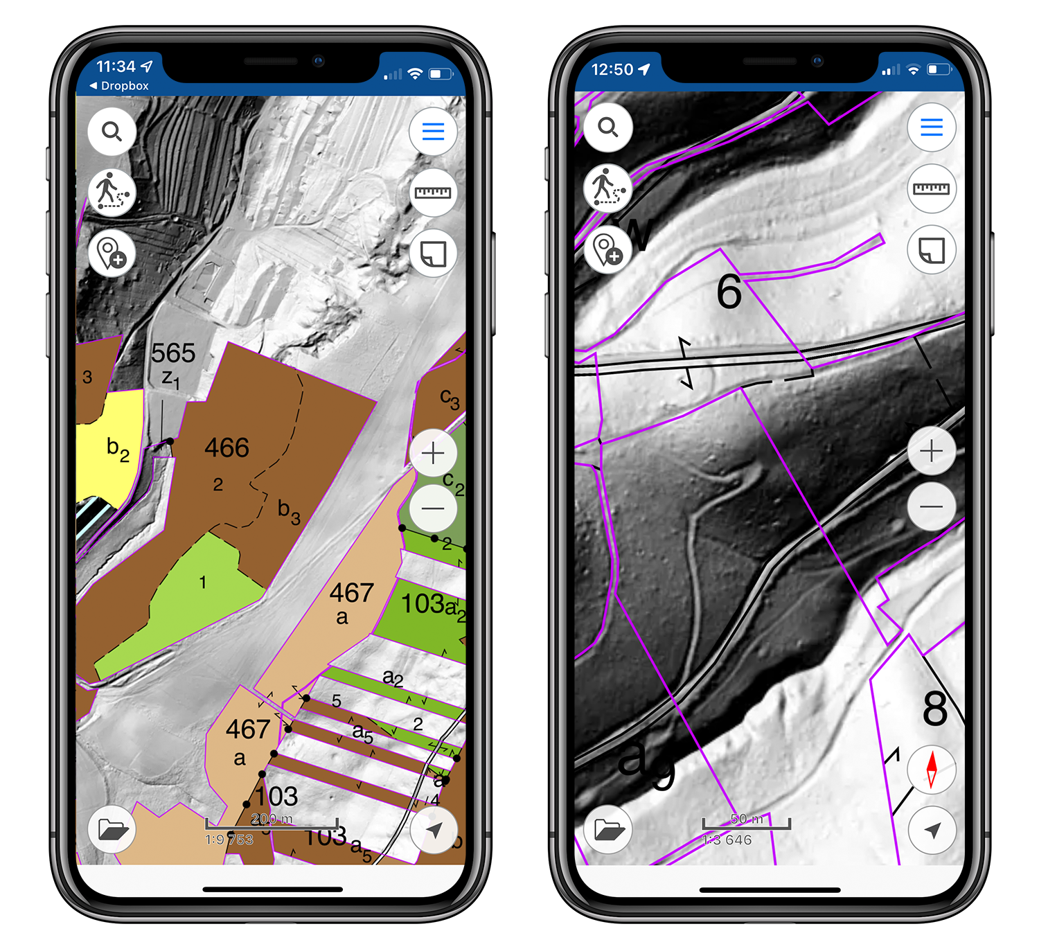
Hillshaded relief map of forest resources
With the needed forest land map on your mobile device, you can quickly navigate a new place, have access to comprehensive information about the forest management activities, look through thematic reference books and find other useful information offline. Advanced functionality of the free CarryMap app enables the fully functional work with the maps regardless of Internet connection and allows to maintain the forest monitoring effectively ensuring the field staff awareness and safety.
Such maps allow to provide a large audience of forest owners with the up-to-date forestry data and do not require additional costs for purchasing licenses for expensive GIS software whilst providing the regulated and controlled access to proprietary data. And owing to the mobile app user-friendliness, working with mobile maps does not require any specific skills from the users. Thus, the forestry employees without GIS background and experience can solve their tasks more effectively, taking advantage of all the benefits of modern GIS technologies.
This case of applying CarryMap technology in forest management demonstrates the ease of involving employees without specific GIS skills in the process of the forestry industry digitalization, the migration to the novel forest management workflows and the development of labor productivity.


